


GPS Field Area Measurement App
3.628.00 Reviews
App Specs
- Version
- 3.0.0
- Updated On
- License
- Free
- Downloads
- 1,000,000+
- Developer
- Bizcraft Apps
- Categories
- Maps & Navigation
- Platform
- Android
Screenshots
 Analysis by AppCompare
When I need a quick estimate of a plot without pulling out specialist equipment, I want the process to be simple: mark the boundary, check the result, and know how much confidence to place in it. GPS Field Area Measurement App is built around that practical job. It is a free mapping and navigation app from Bizcraft Apps, and its appeal is less about replacing professional surveying than making everyday land measurements easier to approach from a phone.
That distinction matters. A GPS reading can be useful for planning a garden project, comparing rough plot sizes, or getting a first estimate while walking a boundary. It should not automatically be treated as a legal survey or a precise basis for expensive construction work. I find the app most useful when I treat its result as a working measurement, then check the boundary and conditions before acting on it.
What I would use it for
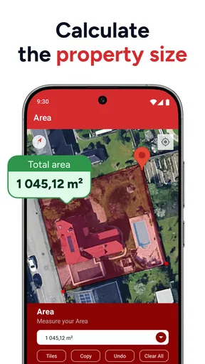
The clearest use case is a space with a boundary you can identify on a map or walk in person. A homeowner could trace a lawn before ordering materials, while a smallholder might sketch a paddock to compare its approximate size with another area. Someone viewing land could also make a quick note to discuss later, rather than relying on a visual guess from the roadside.
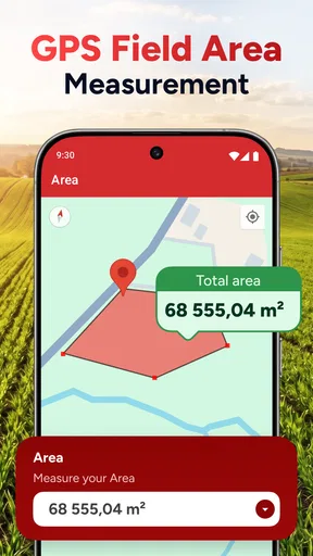
For example, imagine checking a garden before deciding how much seed or ground cover to buy. I would first outline the boundary on the map, then review the shape rather than looking only at the final area figure. A narrow side strip, a curved edge, or a small notch can affect the amount needed. That is a useful reason to slow down and inspect the points instead of treating a single total as the whole answer.
Trust starts with sensible expectations
The app has an average rating of 3.4 from around 3,900 ratings, and it has been installed over a million times. I read those figures as context, not a guarantee that it will behave perfectly on every phone or landscape. GPS measurement depends on conditions as well as software, so a clear open area is a more sensible place to test it than a spot where buildings, trees, or weak reception may make a location reading less steady.
It is rated for Everyone and is free to install, with optional in-app purchases ranging from $0.99 to $99.99 per item. I would check what is available in the app before building a workflow around an extra tool. The current version is 2.1.0, and the app was released on September 16, 2021. These details help set expectations about the product, but they do not turn a phone measurement into certified surveying work.
Location access deserves attention
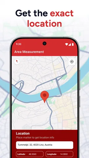
Because this is a GPS-based measuring tool, location access is central to using its field-measurement approach. I would grant location access when I am ready to measure, and pay attention to the choices the phone presents. A map-based workflow can also involve handling places and saved project details, so I would avoid entering sensitive property notes unless I have a clear reason to keep them in the app.
Worth Reading Before You Choose

EA SPORTS FC Mobile 26 Is a Bigger Football Game, but It Takes Time

Flipboard Shows What News Apps Must Do Beyond the Feed

Switching to Android Auto Means Rethinking Your Driving Routine

Google Calendar Makes a Crowded Week Easier to Manage

Ludo King Makes the Most of the Minutes Between Plans

Baby Panda World Brings Quick Play to Modern Phones, but Its Game Library Feels Busy
That is a practical privacy habit, not a claim about how the developer stores or processes information. I check the app’s permission controls on my device and review them again if my use changes. If I only need to calculate a rough area once, there is little reason to leave access broader than the task requires; if I am walking a boundary, location access is part of the job.
Small workflow choices can improve a result
For a boundary that is awkward to walk, I would use the map to place points carefully, then zoom in and inspect corners before saving. A curved edge can be approximated with several sensible points, while adding a point at every tiny change can make the outline harder to manage. The undo option is useful here: it gives me room to correct a misplaced tap instead of starting over.
For a walk-around measurement, I would begin from a recognizable corner, keep a steady pace, and pause if the displayed path seems to drift. I would also repeat the measurement if the result looks implausible. This simple cross-check is especially valuable on an irregular plot, where one inaccurate segment can distort the overall shape more than it would on a neat rectangle.
Where another tool may be better
Compared with estimating from a paper map or eyeballing a boundary, a GPS measuring app is convenient because I can work on site and keep a record of the outline. Compared with dedicated surveying equipment or a professional survey, though, it is a lighter option with fewer reasons to trust it for high-stakes decisions. If a boundary affects a purchase, a dispute, planning approval, or a major build, I would seek a qualified measurement rather than rely on a phone result.
It may also be the wrong choice if you need dependable measurements indoors, under dense cover, or in a place where your phone struggles to obtain a stable GPS position. For those situations, a tape measure, a site plan, or specialist equipment may be more appropriate. The app makes an accessible estimate easier; it cannot remove the limits of the method.
Getting Started with Precision
First off, downloading and setting up the GPS Field Area Measurement App is a breeze. Available on both Android and iOS, the app welcomes you with a straightforward interface. No unnecessary fluff, just the essentials right there at your fingertips. Once you fire it up, it asks for location permissions – pretty standard for a GPS app. I found it quick and responsive, which is always a good start.
Exploring the Features
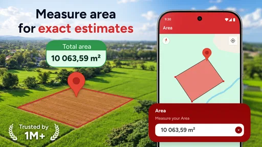
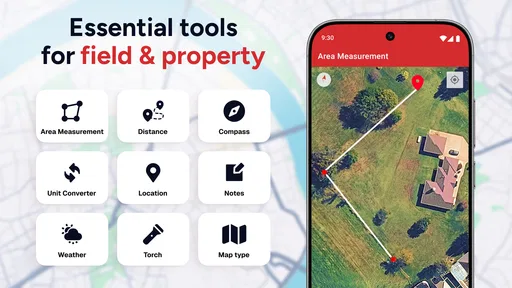
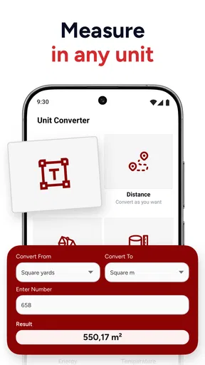
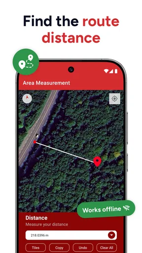
Now, onto the fun part – the features. The app lets you measure areas and distances with impressive accuracy. You can choose from multiple measurement units, which is a nice touch for those who prefer acres over hectares. The interface is intuitive; just tap to set your points on the map, and the app does the rest. It calculates the area, perimeter, and even lets you save your measurements for later. Pretty neat, right?
What I love about this app is its versatility. You can use it for anything from measuring your backyard to mapping out a large farm. The developers clearly thought of everything, including a handy "Undo" feature for those of us prone to tapping the wrong spot.
Real-Time GPS Tracking
One of the standout features is the real-time GPS tracking. As you walk or drive around the perimeter of the area you're measuring, the app updates instantly. This live feedback is incredibly helpful, especially if you're covering a large area. I took it for a test run in a local park and was impressed by how accurately it tracked my path.
Mapping with Ease
Another cool thing is the app's ability to switch between different map views. You can toggle between satellite, terrain, and standard maps, depending on what suits your needs. I found the satellite view particularly useful for getting a clear picture of the land I was measuring.
Sharing and Saving Your Data
Once you've got your measurements, sharing them is a cinch. The app allows you to export data in different formats, making it easy to integrate with other tools you might be using. Whether you're sending it to a colleague or saving it for your records, the process is seamless.
Plus, all your projects can be stored within the app, so you can revisit them anytime. This feature is a lifesaver for anyone managing multiple properties or projects.
Any Downsides?
Of course, no app is perfect. While the GPS Field Area Measurement App performs well overall, it can sometimes be a bit off if the GPS signal is weak. This isn't a deal-breaker, but it's something to keep in mind if you're working in an area with spotty reception. Also, while the app is free, some features are locked behind a paywall, which might not be ideal for everyone.
Before committing to a paid feature, I would first work through one small test measurement and see whether the free options cover the task. That helps avoid paying for something that turns out not to fit your workflow. The listed purchase range is broad, so checking the individual item and its purpose matters more than assuming every useful tool requires an upgrade.
Final Thoughts
In the grand scheme of things, the GPS Field Area Measurement App is a solid tool for anyone needing to measure land quickly and accurately. Its ease of use, coupled with a rich set of features, makes it a worthwhile download. Whether you're managing a farm or just curious about the size of your backyard, this app has got you covered.
I would recommend it to someone who wants a convenient estimate, can work outdoors, and is comfortable checking the outline before relying on the number. I would not choose it as the sole source for a legal boundary or a costly project decision. That is the key trade-off: a phone makes measuring approachable, but the user still needs to judge when an estimate is enough and when a more authoritative method is needed.
So, next time you're out in the field and need to know just how big it really is, don't sweat it. Grab your phone, fire up the app, and let it do the heavy lifting. Happy measuring!
Pros
- Accurate real-time GPS tracking.
- User-friendly interface for easy navigation.
- Supports multiple measurement units.
- Offline mode for remote locations.
- Detailed area and perimeter calculations.
Cons
- Limited features in free version.
- Battery consumption can be high.
- Requires stable GPS signal.
- Ads in the free version can be intrusive.
- Occasional lag in dense areas.
FAQs for GPS Field Area Measurement App
What is the GPS Field Area Measurement app used for?
The GPS Field Area Measurement app is designed to help users accurately measure areas and distances in real-time using GPS technology. It's particularly useful for agriculture, landscaping, or any field where precise area measurement is required. The app provides a user-friendly interface allowing for quick calculations and mapping.
How accurate is the measurement provided by the app?
The accuracy of the GPS Field Area Measurement app depends on several factors, including GPS signal strength and environmental conditions. Generally, it provides accurate measurements suitable for most practical applications, but for highly precise requirements, users should consider professional equipment. The app is constantly updated to improve precision and reliability.
Can I use the app offline?
Yes, the GPS Field Area Measurement app offers offline functionality. While GPS data requires a connection to satellites, the app allows users to download maps and measurement data for offline use. This feature is particularly useful in remote areas where internet connectivity may be limited or unavailable.
Is the GPS Field Area Measurement app user-friendly for beginners?
The app is designed with user-friendliness in mind, making it accessible for beginners. It features an intuitive interface with easy-to-follow instructions, tutorials, and support. Users can quickly learn how to measure areas and distances with step-by-step guidance, making it a practical tool for users of all experience levels.
What devices are compatible with the GPS Field Area Measurement app?
The GPS Field Area Measurement app is compatible with most Android and iOS devices that have GPS capabilities. Users should ensure their device is running a supported version of the operating system for optimal performance. Regular updates are provided to enhance compatibility and functionality across various devices.


